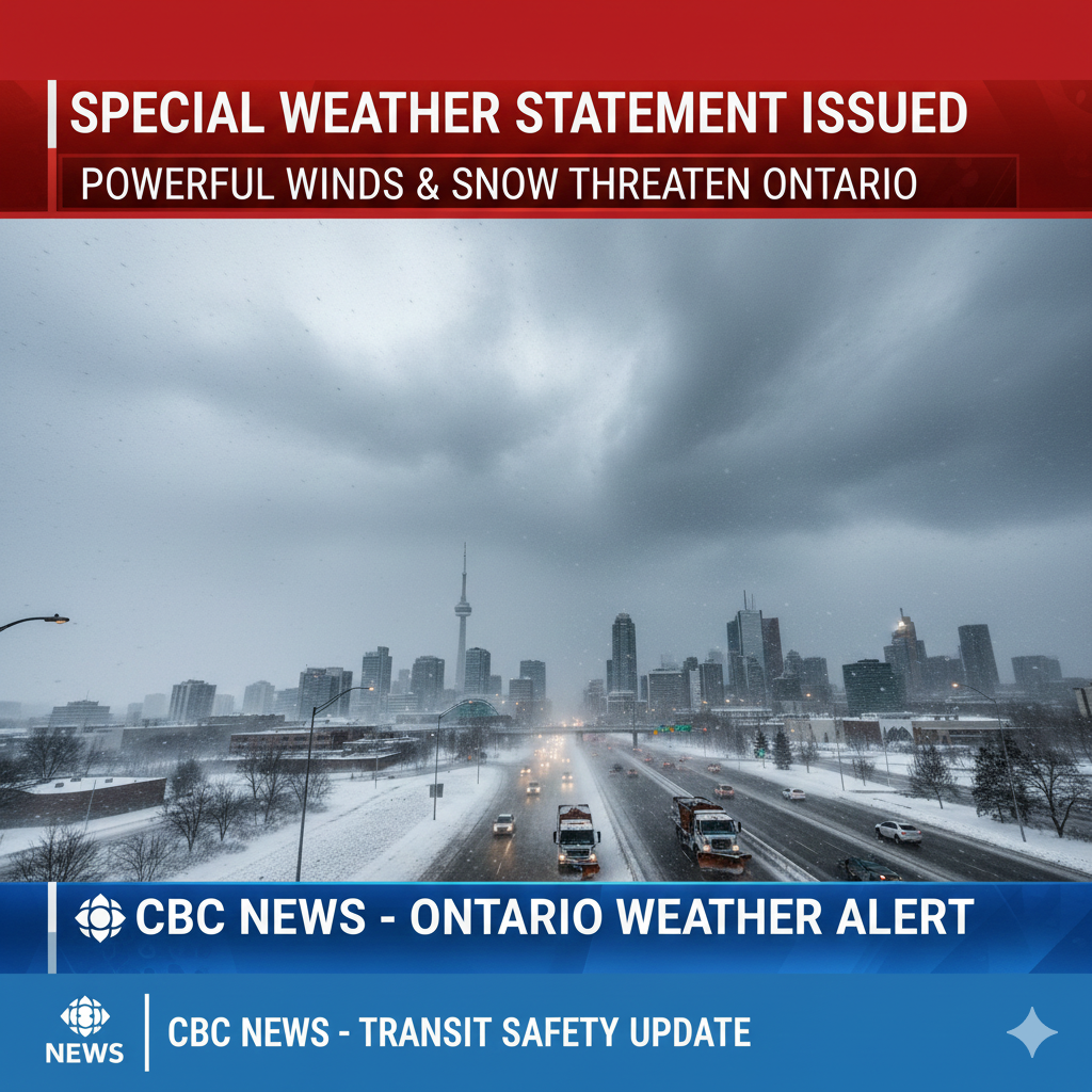
Toronto Braces for Severe Wind Event and Potential Snowfall
Environment Canada has issued a special weather statement warning Toronto residents and surrounding communities to prepare for strong winds, possible snow, and deteriorating travel conditions as a significant weather system moves into southern Ontario. The federal weather agency says the storm, expected to begin Wednesday and continue into late Thursday or early Friday, could bring gusts reaching 70 to 80 kilometres per hour, creating the risk of power disruptions, falling debris, and hazardous driving conditions across the region.
Meteorologists say this system marks the first major winter weather event of the season for much of southern Ontario, combining intense winds with the potential for wet, heavy snow in some areas. While Toronto itself may experience more modest snowfall, areas north and west of the city are forecast to see more substantial accumulations, heightening concerns for motorists and local infrastructure.
Strong Winds Expected to Impact Urban and Suburban Areas
According to Environment Canada, the primary threat for Toronto will be powerful winds capable of causing localized damage and travel disruptions. Gusts of up to 80 km/h are expected to begin Wednesday and persist through Thursday night, affecting not only the city core but also the Greater Toronto Area (GTA).
Directional Shifts Could Intensify Conditions
Meteorologists noted that winds will initially blow from the southwest before shifting westward Wednesday night and then to the northwest by Thursday afternoon or evening. These changing wind directions could intensify the effects of the storm, especially when combined with snowfall, resulting in reduced visibility and drifting snow on major roads and highways.
Environment Canada warned that high-sided vehicles, including transport trucks, buses, and delivery vans, could be pushed off course by the gusts. Loose outdoor items such as garbage bins, patio furniture, and construction materials may also become airborne hazards, posing risks to pedestrians and property.
Snowfall Could Create Treacherous Road Conditions
While Toronto may receive limited snowfall, communities to the north and west are expected to bear the brunt of the storm. Environment Canada climatologist emeritus David Phillips told CBC Radio’s Metro Morning that areas such as Barrie and Guelph could see significant snowfall beginning late Wednesday afternoon and intensifying overnight.
Phillips cautioned that the combination of wind and snowfall will likely result in blowing and drifting snow, which could severely impair visibility and make travel dangerous, particularly on rural highways and open stretches of road.
First Major Winter Storm of the Season
Phillips described the approaching system as a notable milestone for the region’s winter weather timeline, calling it “the first real, significant event of the winter.” He emphasized that even modest snowfall in Toronto could become problematic when compounded by strong gusts and dropping temperatures during the overnight hours.
Drivers in affected areas are being urged to anticipate slower travel times, slick road surfaces, and the possibility of temporary road closures, particularly in counties where snow accumulation is predicted to be heavier.
Potential for Power Outages and Infrastructure Impacts
In addition to hazardous travel, officials are warning of possible service disruptions due to the strength of the winds. Environment Canada advised that falling branches, downed power lines, and wind damage to structures could result in isolated power outages, especially in suburban and rural communities with older infrastructure or significant tree cover.
Residents are encouraged to secure loose items around their properties and check that emergency supplies such as flashlights, batteries, and backup phone chargers are accessible in case of service interruptions.
Safety Advisory for Residents and Commuters
Transportation and safety authorities are urging the public to exercise caution throughout the storm period. Motorists should allow extra travel time, maintain a safe distance from other vehicles, and avoid unnecessary trips during peak storm conditions.
Key Precautionary Measures
Residents are advised to:
- Secure outdoor objects that could be blown away.
- Avoid parking vehicles under trees or power lines.
- Monitor weather updates and official warnings.
- Prepare for sudden changes in road and weather conditions.
- Consider delaying non-essential travel until conditions improve.
Pedestrians should remain alert for falling debris and take extra care when walking near construction zones or older buildings, where materials may become dislodged by strong gusts.
Regional Impacts Beyond Toronto
The special weather statement extends beyond the city, covering much of southern Ontario. Communities from Windsor to Kingston are monitoring the system closely, with local officials preparing response measures in case of worsening conditions.
In more snow-prone areas such as Huron, Wellington, Simcoe, and Grey counties, meteorologists say lake-effect snow could develop as colder air moves over the Great Lakes. This phenomenon may significantly increase snowfall totals in localized pockets, further complicating travel and emergency response efforts.
Emergency Services on Alert
Municipal emergency services and utility providers have been placed on standby as the storm approaches. Crews are prepared to respond to reports of downed trees, power outages, and collisions resulting from poor road conditions. City officials have also reminded residents to remain cautious and report any hazardous conditions to local authorities.
Toronto’s transportation agencies are monitoring road networks and public transit operations to ensure continuity of service where possible. However, officials caution that severe conditions may still result in delays or temporary disruptions.
Outlook for the Coming Days
Forecast models indicate that conditions could gradually improve by late Friday morning. However, lingering winds and residual snowfall may continue to impact travel and daily activities even after the storm’s peak has passed.
Residents are advised to stay updated through official weather bulletins and emergency alerts as the situation evolves. Environment Canada continues to monitor the storm system closely and may issue further warnings or advisories if conditions intensify.
Conclusion: Vigilance Urged as Winter Conditions Set In
As Toronto and southern Ontario prepare for this significant shift in weather, authorities are emphasizing the importance of preparation and awareness. The combination of strong winds and potential snowfall represents a clear reminder of winter’s arrival and the challenges it brings.
By taking proactive steps, monitoring official guidance, and exercising caution on the roads and in public spaces, residents can minimize risks and stay safe as the storm unfolds. Environment Canada’s special weather statement serves as an early warning to ensure communities are ready for what could be one of the most impactful weather events of the early winter season.
Leave a Reply